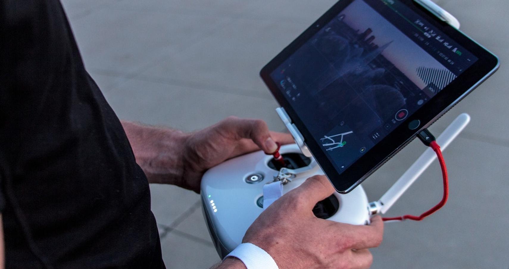
Drone apps are meant to assist in a better flight experience and provide a euphoric aerial view. Among numerous applications claiming to make it best out of your flight experience, here we list the best drone apps that will give an edge to drone pilots.
Camera drones have been a regular technology assisting people in various occupations, not just photographers. Hence, drone piloting seems to emerge as a promising but very challenging career opportunity. From farm field inspection to security check purposes, an aerial view does it all.
The drone apps serve you with fly zones, altitude limits, calculations, aerial analysis, weather insights, advisories, etc. The best drone apps align with your smartphone or tablet seamlessly to bring the best out of your flight mission.
Table of Contents
Let’s dive into the list of the Top 10 best apps for Drone Pilots-
1. AirMap
The best in business, AirMap helps drone pilots with fly zones. Collaborating with the FAA (Federal Aviation Authority) database, AirMap assures the fly zones on the map according to regulations and authorizes your flight plans within the flying limits. AirMap provides three types of advisories, i.e., Red, Orange & Green. As is evident, red means you can’t fly your drone in the zone.
The Orange region allows your flight within the authorization suggested on the map, as your flight gets authorized on the go if you don’t breach the altitude limits.
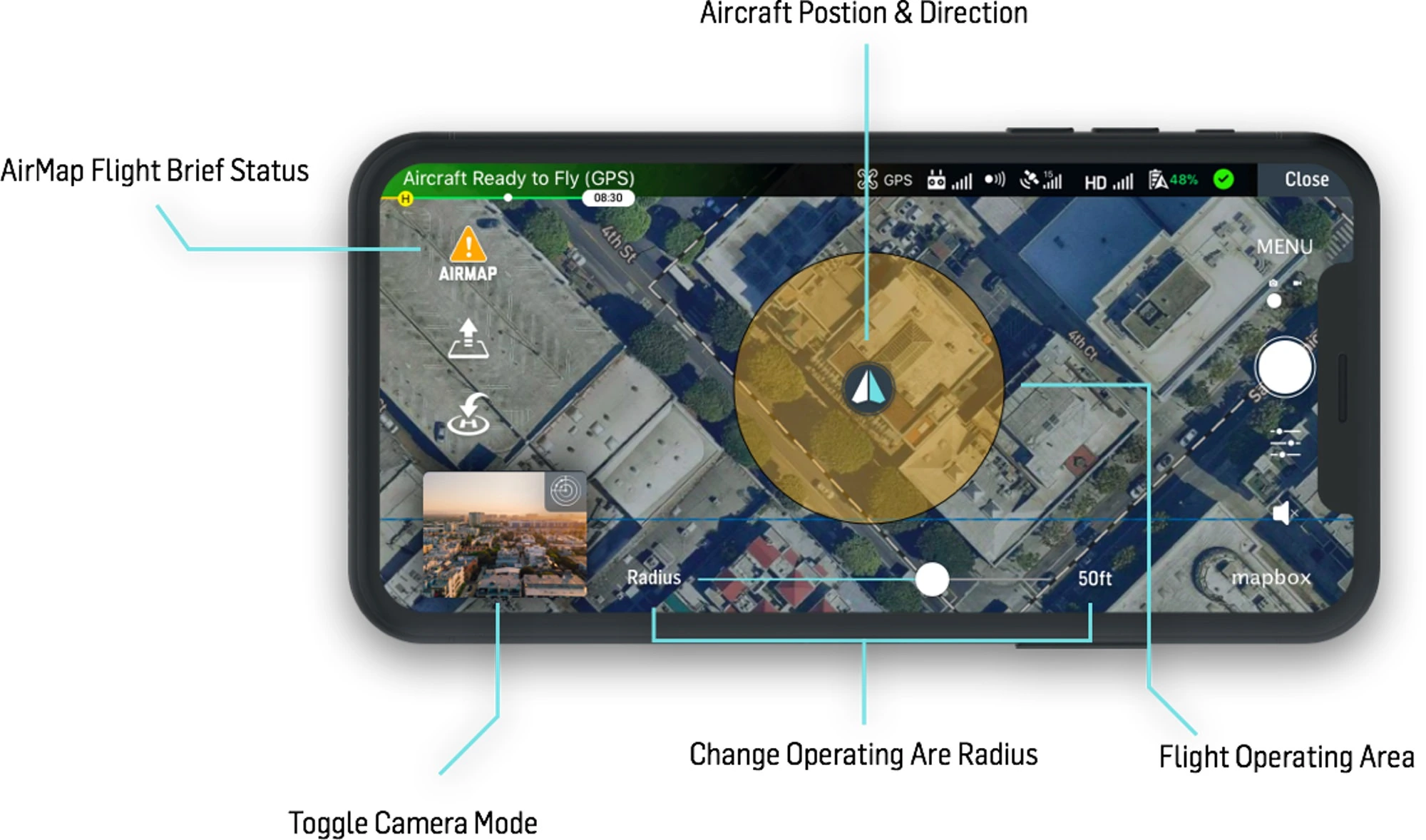
Finally, a green zone is free to fly the drone far and high. After submitting your flight request on the app, it also serves you with important aviation data such as wind speed, weather visibility, and direction of the wind. AirMap makes it mandatory for all drone pilots with its on-the-go and hassle-free authoring features.
2. DJI Go 4
DJI Go 4 is one app that every drone pilot banks on. This drone app provides important information and helps you know more about your aircraft and the weather around you. Built with Google Maps, it uses satellites to inspect the region. The DJI Go 4 app brings the most out of the drone flight experience, providing better visuals on your phone through the drone’s camera.
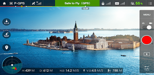
The major function of this app is to provide real-time video transmission and also to line up several intelligent flight modes and camera adjustment tools. DJI Go 4 brings the best out of a compatible drone, and it is that one app doing it all for the pilots on the same page.
3. UAV Forecast
UAV Forecast does the weather forecast before your flight and more of it. This app helps with wind speed, number of locked satellites, cloud coverage, visibility, and temperature on the go.
The features are very handy for adjusting your flight according to the aerial conditions, and the best suited for small drones that can’t withstand extreme weather conditions.
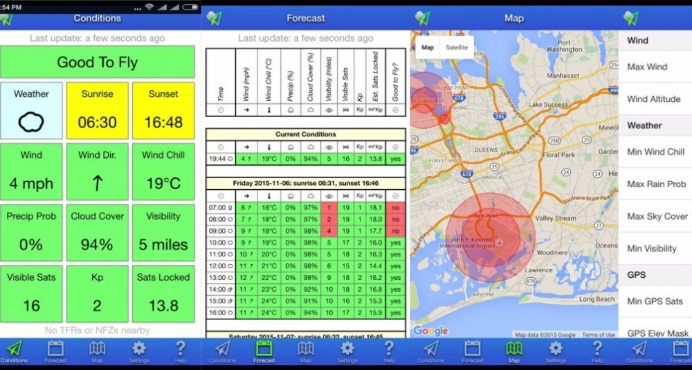
As suggested by the name of the app, the forecast future predicts the change in weather, and often makes very accurate predictions. Automated color-code analysis and theme switch features only make it better. The UAV Forecast app interface makes it simple and effective for drone pilots to plan their flight missions.
4. DroneDeploy
DroneDeploy is a highly recommended app among the drone pilot community for mapping and making 3D models out of the pictures captured with their aircraft. The DroneDeploy app emphasizes the drone as a powerful tool to gather the best out of the scenes. The automated picture analysis feature is by far the best in the business.
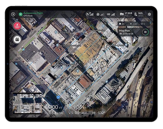
The app also provides you with heat maps, roof inspection measurements, and more. Although the app comes with a paid subscription, it allows a 30-day free trial to try your hand, and is surely worth it for professional drone pilots.
5. Tesla Field Recorder
Tesla Field Recorder works on a very rare program of magnetic interference. This app does good work for research and exploration purposes, detecting and recording magnetic fields around and enhancing a drone’s ability to detect locations.
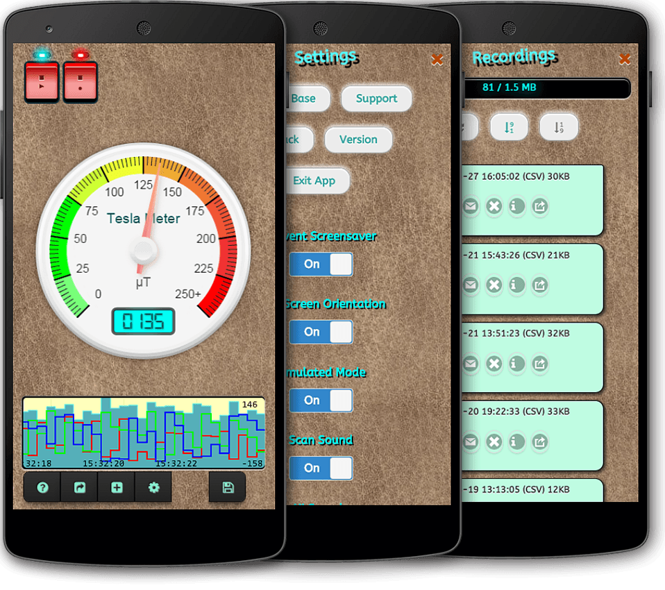
The app is a tool to analyze high magnetic fields that may create disturbances during the flight mission. Hence, the Tesla Field Recorder is a more important tool for location analysis and avoiding serious magnetic disturbances.
6. Hover
Hover is one app that does the same as any other drone app, but the better part is how simple it does the same. The app provides accurate and apparent No-Fly Zones data with temporary and permanent flight restrictions.
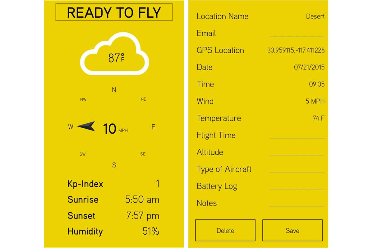
Real-time weather prediction enhances flight efficiency and assures a safer flight planning option. Hover also precisely transforms images into 3D models with accurate and transparent estimates, cutting human errors. The simple app interface with highly loaded features makes it a favorite among drone pilots.
7. PhotoPills
PhotoPills is the one photography planning app a drone pilot must consult. The app helps you plan your photography better ahead of time by suggesting the right place and angles at the right time. It makes it possible to learn the amount of light you will get around the lens to capture the best possible frame.

The app accesses the Drone View feature, which allows you to adjust compositions as per the altitude once the drone is at the top. The PhotoPills app gives you an edge in capturing celestial bodies and extended landscape views.
8. Sun Surveyor
Sun Surveyor analyses the best possible altitude spot to capture the most out of the natural scenery. The app detects better spots such as “Golden Hour” & “Blue Hour” as special mentions of stages that occur specifically during a particular time and weather.
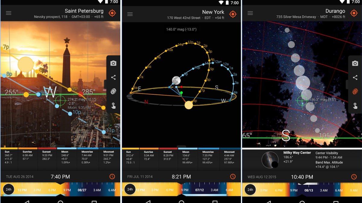
The “Golden Hour” adds a more scenic background to the frame while the “Blue Hour” emphasizes the dynamic part of the visual. The Sun Surveyor app is, however, complex to get used to, but once you are up to it, there is no going back to your high-altitude photography skills.
9. Google Earth
Google Earth is a simple yet very important app for drone pilots traveling and exploring new places. The app ensures detailed 3D visuals of the landscape, which makes it easy to judge a place way before visiting it. Google Earth adds an edge to your planning.
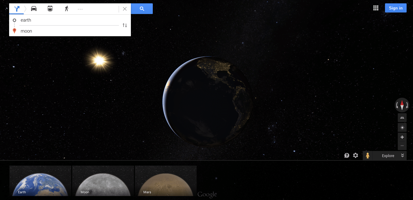
The app interface makes it easy to understand the geography of the region even before reaching there. Drone pilots also use this app to explore hidden places around them. Hence, it is the best app to plan your flight and judge the aviation scenario.
10. DroneInsurance.com
Droneinsurance.com covers the flight liability risk, allowing you to ensure your drone is hassle-free for as little as a day and as long as a year online. They offer drone flight coverage under various options of Base Coverage, On-demand Flight Liability Coverage, and Optional Physical Damage Protection.
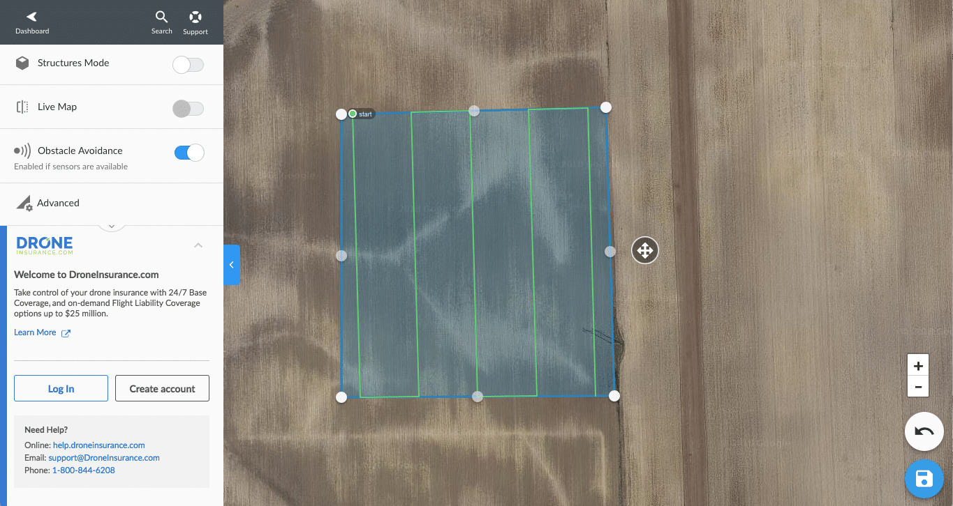
As drone flights are a risky business to go without backing, Droneinsurance.com is a highly trusted platform among the drone pilot community to cover aerial liability risk with minimum fuss.
Also Checkout: 10 Best Detective Games You Should Try


